Bring Any Data for Quality Control into MeshInspector
Effortlessly import your CAD and scan result data into MeshInspector, regardless of object size. MeshInspector supports common formats used for quality control, ensuring seamless inspection of various data types:
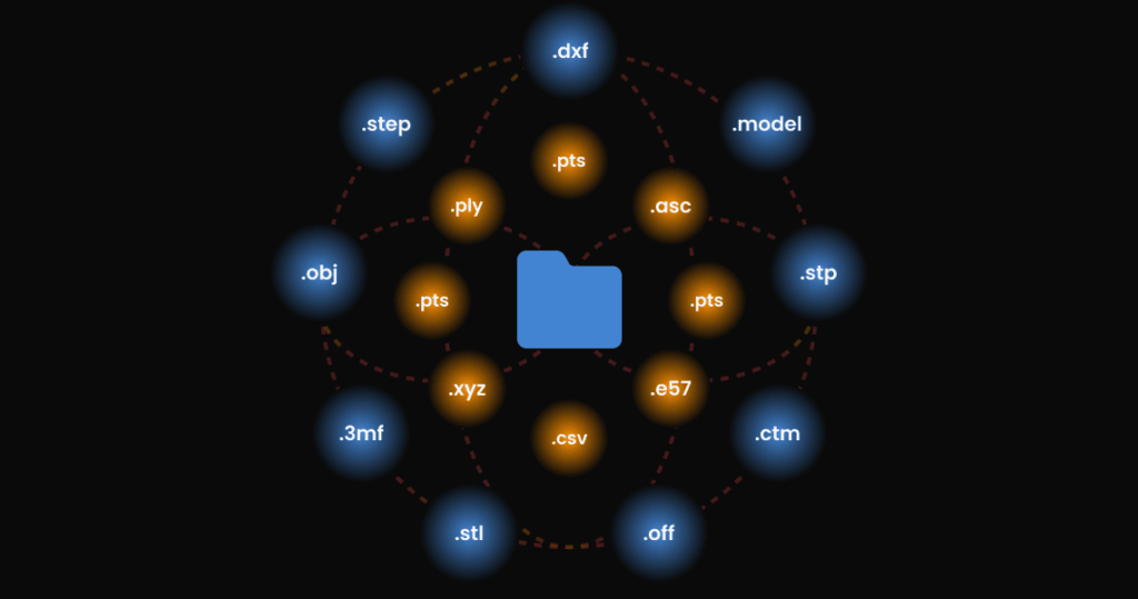
CAD data formats: .dxf, .step, .stp, .stl, .obj, .off, .ctm, .3mf, .model.
Point Cloud Formats: .ply, .pts, .asc, .csv, .xyz, .e57, .las, .laz
MeshInspector’s rendering capabilities enable rapid viewing and inspection of parts. Enjoy quick and smooth rendering without file size limitations. Access and view your data on-the-go using tablets or mobile devices.
Prepare Your Data for comparison
MeshInspector simplifies the process of aligning and merging multiple scans into one cohesive 3D model. Benefit from these easy-to-use alignment methods:
- Pairwise Registration: Align two scans at a time for detailed accuracy.
- Global Registration: Automatically align all scans in the entire scene for quick results.
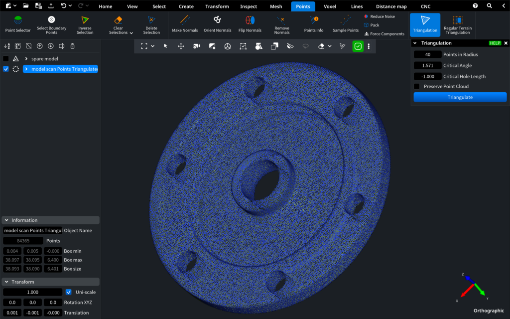
Clean up your scan data to prepare it for inspection and analysis. Our advanced algorithms harness your CPU’s power to deliver blazing-fast conversion speeds. MeshInspector offers a suite of tools to streamline this process.
- Noise Reduction: Clear away unwanted noise for better data clarity.
- Outlier Removal: Automatically eliminate outliers to enhance accuracy.
- Decimation (Sample Points): Decrease point density while retaining crucial details for quicker processing.
- Isolate the Area of Interest: Visualize CT or MRI scans in three dimensions, isolating layers of interest based on density.
- Ultra-Fast Mesh Conversion: Our advanced algorithms harness your CPU’s power to deliver blazing-fast conversion speeds, utilize Triangulation, Fusion, or regular terrain triangulation to convert your point cloud to a solid model.
Merge the aligned scans into a single file, creating a complete and accurate 3D model. Ideal for construction, archaeology, and manufacturing, this process ensures you have precise 3D models for analysis, documentation, and planning. These tools ensure that your scan data is clean and high-quality, ready for precise analysis and planning in industries like construction, archaeology, and manufacturing. Convert point clouds into meshes quickly and seamlessly, ensuring smooth workflows and minimal interruptions.
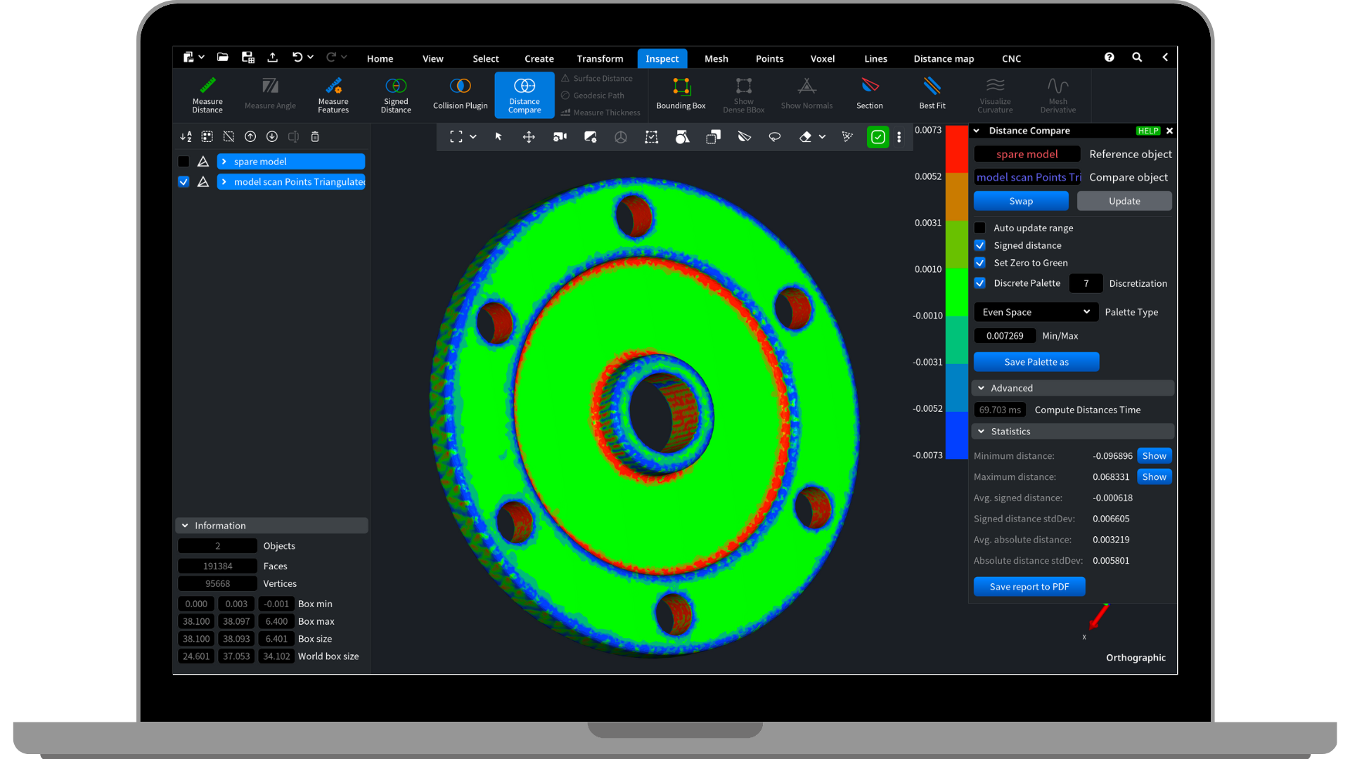
Compare your CAD model with a Produced model
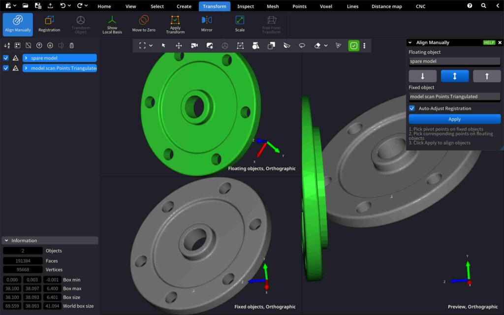
Achieve precise alignment of multiple models with our flexible alignment options:
- Automatic Alignment (Registration): Seamlessly align models in one click.
- Manual Alignment: Manually select reference points on each model for detailed accuracy.
Visually compare the original design with the produced result using the “Distance Compare” tool:
- Color Deviation Map: Utilize a color distance map to meticulously analyze surface disparities such as protrusions, bulges, dents, or slots.
MeshInspector provides tools for accurate alignment and detailed comparison, empowering you to inspect the quality of your printed 3D models against the original CAD designs and identify even the most minor deviations to meet the highest standards.
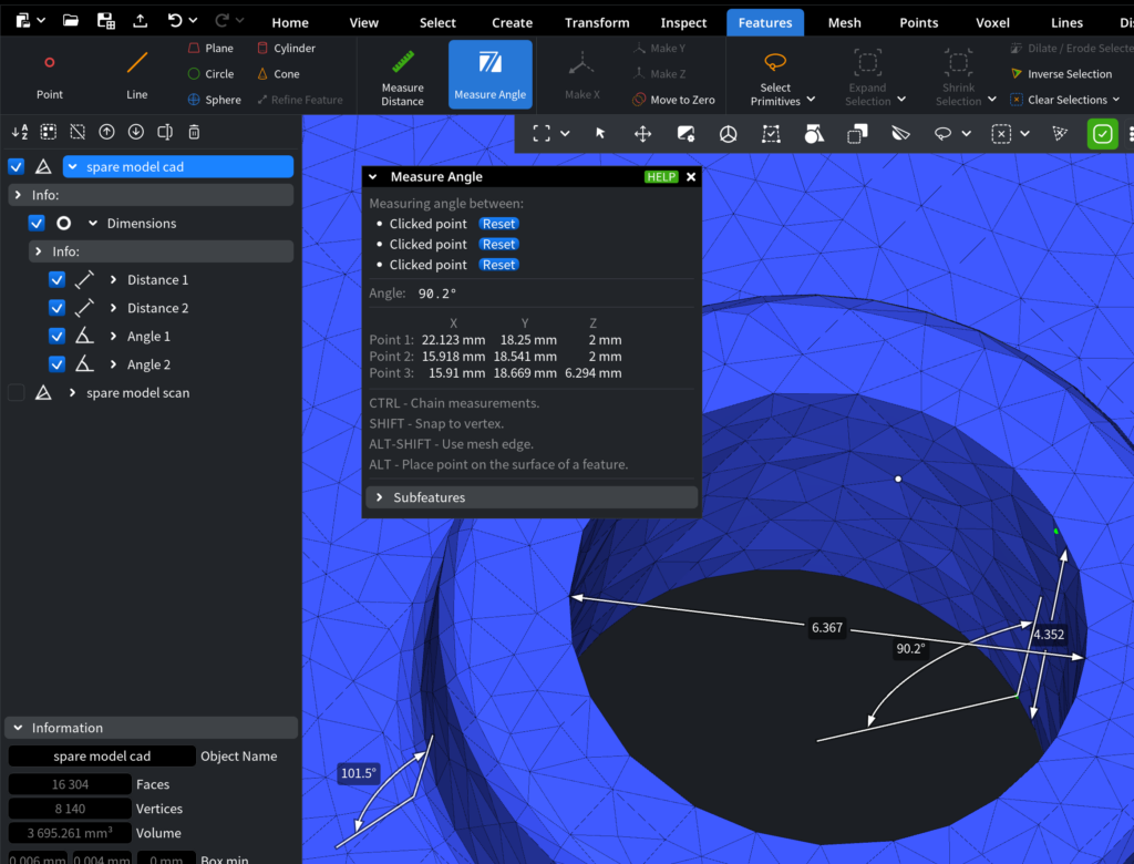
Conduct Measurements
MeshInspector offers robust tools for measurement, allowing you to make all the calculations quickly:
- Measure Distance & Angles: Display distances between selected objects and measure angles between selected edges.
These tools help you identify key features and perform quality control operations efficiently, ensuring precise measurements and adherence to design specifications.
Download PDF Reports
Access comprehensive PDF reports containing detailed information for thorough analysis. These reports provide insights into distance comparisons, visual comparisons, and average statistics, enabling informed decision-making to uphold project precision and compliance with industry standards. Collaborate effectively by easily sharing these reports with your team.

Watch MeshInspector in Action
FAQs
MeshInspector supports a wide range of formats, including CAD data formats (.dxf, .step, .stp, .stl, .obj, .off, .ctm, .3mf, .model) and point cloud formats (.ply, .pts, .asc, .csv, .xyz, .e57, .las, .laz).
Yes, MeshInspector efficiently handles large-scale scans, enabling smooth processing and detailed analysis of extensive data sets without file size limitations.
MeshInspector offers flexible alignment options including Manual Alignment, Pairwise Registration, and Global Registration, allowing for precise control and quick results in aligning multiple scans or models.
MeshInspector includes tools such as Noise Reduction, Outlier Removal, and Decimation (Sample Points) to ensure your scan data is clean and ready for accurate 3D modeling and inspection.
MeshInspector provides the “Distance Compare” tool, which utilizes a Color Deviation Map to meticulously analyze surface disparities and ensure your produced model meets the highest standards when compared to the original CAD design.
Yes, MeshInspector includes robust tools for measuring distances and angles, helping you perform quality control operations efficiently and ensuring adherence to design specifications.
Yes, MeshInspector allows you to download comprehensive PDF reports containing detailed information on distance comparisons, visual comparisons, and average statistics, enabling informed decision-making and effective collaboration with your team.