3D Data Processing Software
Surveying & Digitizing
Bring Your Asset to Production — Rocket-Fast!
Bring Any Scanner Data into MeshInspector
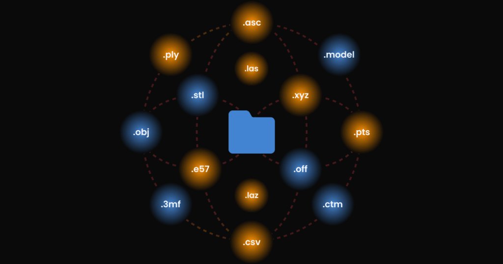
Easily import your scanner data into MeshInspector, regardless of object size. MeshInspector supports common formats used by major Lidar, laser, and photogrammetry scanners:
Mesh formats: .stl, .obj, .off, .ctm, .3mf, .model
Point Cloud formats: .ply, .pts, .asc, .csv, .xyz, .e57, .las, .laz
MeshInspector’s rendering capabilities enable quick viewing and inspection of large scan objects, such as buildings or ships, effortlessly handling even substantial sizes. This versatility ensures smooth integration and efficient analysis of your scan data, no matter the scanner type.
Effortlessly Clean Up Point Clouds
MeshInspector makes it simple to tidy up your point cloud data with the following tools:
- Noise Reduction: Clear away unwanted noise for better data clarity.
- Outlier Removal: Automatically eliminate outliers to enhance accuracy.
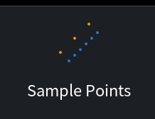
- Decimation (Sample Points): Decrease point density while retaining crucial details for quicker processing.
These features ensure your point cloud data is clean and high-quality, ideal for producing accurate 3D models in industries like construction, archaeology, and manufacturing. Make sure your data is ready for precise analysis and planning.
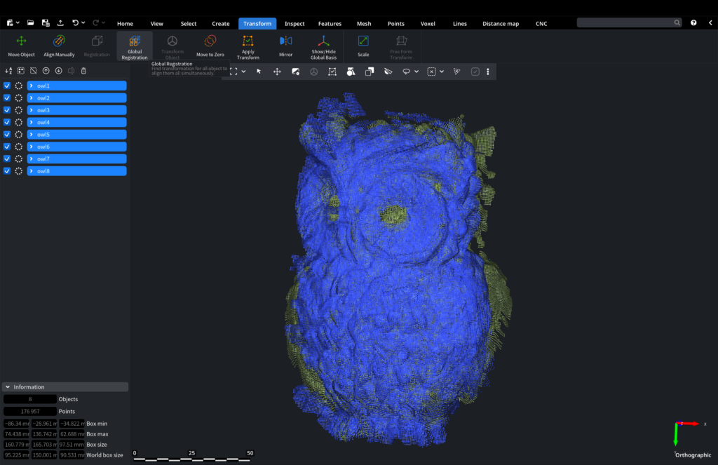
Align Multiple Scans into a Single 3D Model
MeshInspector simplifies the process of aligning and merging multiple scans into one cohesive 3D model. Benefit from these easy-to-use alignment methods:
- Manual Alignment: Click three points on each scan to align them manually for precise control.
- Pairwise Registration: Align two scans at a time for detailed accuracy.
- Global Registration: Automatically align all scans in the entire scene for quick results.
- Feature Matching: Align scans by matching key features for improved accuracy and efficiency.
Merge the aligned scans into a single file, creating a complete and accurate 3D model. Ideal for construction, archaeology, and manufacturing, this process ensures you have precise 3D models for analysis, documentation, and planning.
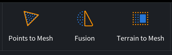
Ultra-Fast Mesh Conversion
Our advanced algorithms utilize your CPU’s power to achieve blazing-fast conversion speeds.
- Triangulation mode: Focus on capturing intricate details.
- Fusion mode: Prioritize swift processing.
- Regular Terrain Triangulation mode: Specifically designed for creating 3D printable terrain scans.
Convert point clouds into meshes quickly and seamlessly, without interruption.
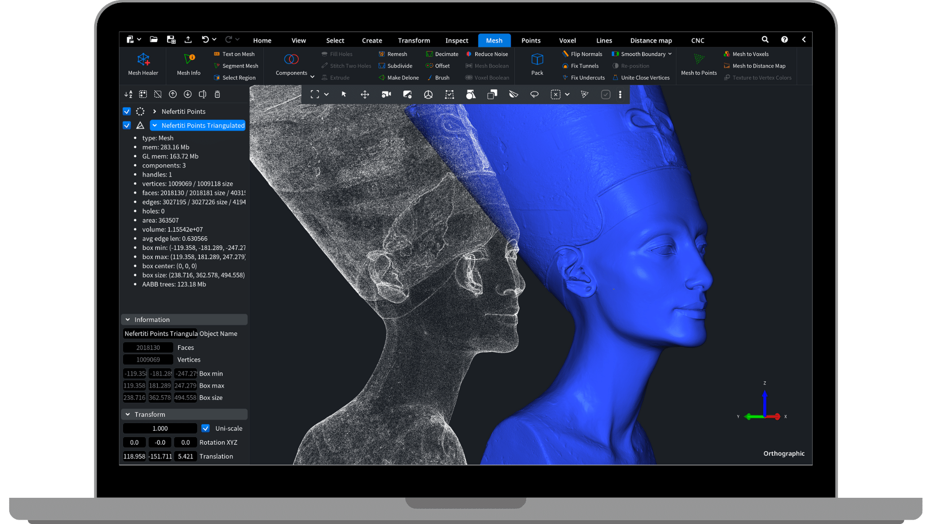
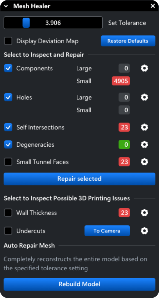
Inspect and Repair any mesh errors using Mesh Healer
Utilize Mesh Healer to swiftly identify and repair any mesh errors, ensuring your models are flawless.
Inspect meshes for multiple components, holes, self-intersections, degeneracies (short and multiple edges), overhangs, and thin walls.
Activate Mesh Healer to seamlessly seal surfaces, preparing them for digitization. It’s that straightforward!
Ensure your models are error-free and ready for seamless digital integration, free from defects.
FAQs
MeshInspector supports common mesh formats such as .stl, .obj, .off, .ctm, .3mf, and .model, as well as point cloud formats including .ply, .pts, .asc, .csv, .xyz, .e57, .las, and .laz.
Yes, MeshInspector is equipped to handle large-scale scans efficiently, ensuring smooth processing and analysis of extensive data sets.
MeshInspector offers precise alignment tools, allowing users to align scans manually by selecting key points or using automated pairwise and global registration methods.
MeshInspector includes tools for noise reduction, outlier removal, point filtering, and decimation to clean and refine point cloud data for accurate 3D modeling.
Yes, MeshInspector includes features like regular terrain triangulation and mesh healing tools to prepare models for 3D printing, ensuring they are watertight and printable.
Yes, MeshInspector’s Mesh Healer tool identifies and repairs mesh errors such as holes, self-intersections, overhangs, and thin walls, ensuring models are defect-free.
Yes, MeshInspector is designed for professional applications in various industries, providing robust tools for precise 3D scanning, modeling, and analysis.
Yes, MeshInspector supports color information in formats like .obj and .ply, allowing users to visualize and analyze scanned objects with their original colors intact.
Yes, MeshInspector includes measurement tools that allow users to accurately measure dimensions, distances, angles, and other geometric properties directly within the 3D models.