
Image to Distance Map (Distance Maps › Image to Distance Map) reads a grayscale image and turns its brightness into height: a distance map or, with one checkbox, a mesh. Use it to make a relief from a height map, a logo or a depth image, including one saved earlier with Distance Map to Image.
Images do not open with Open Files; load them with this tool.

Load an image
- Click Image to Distance Map. A file window opens.
- Choose a PNG, JPEG or TIFF file and click Open. The Image to Distance Map panel opens.
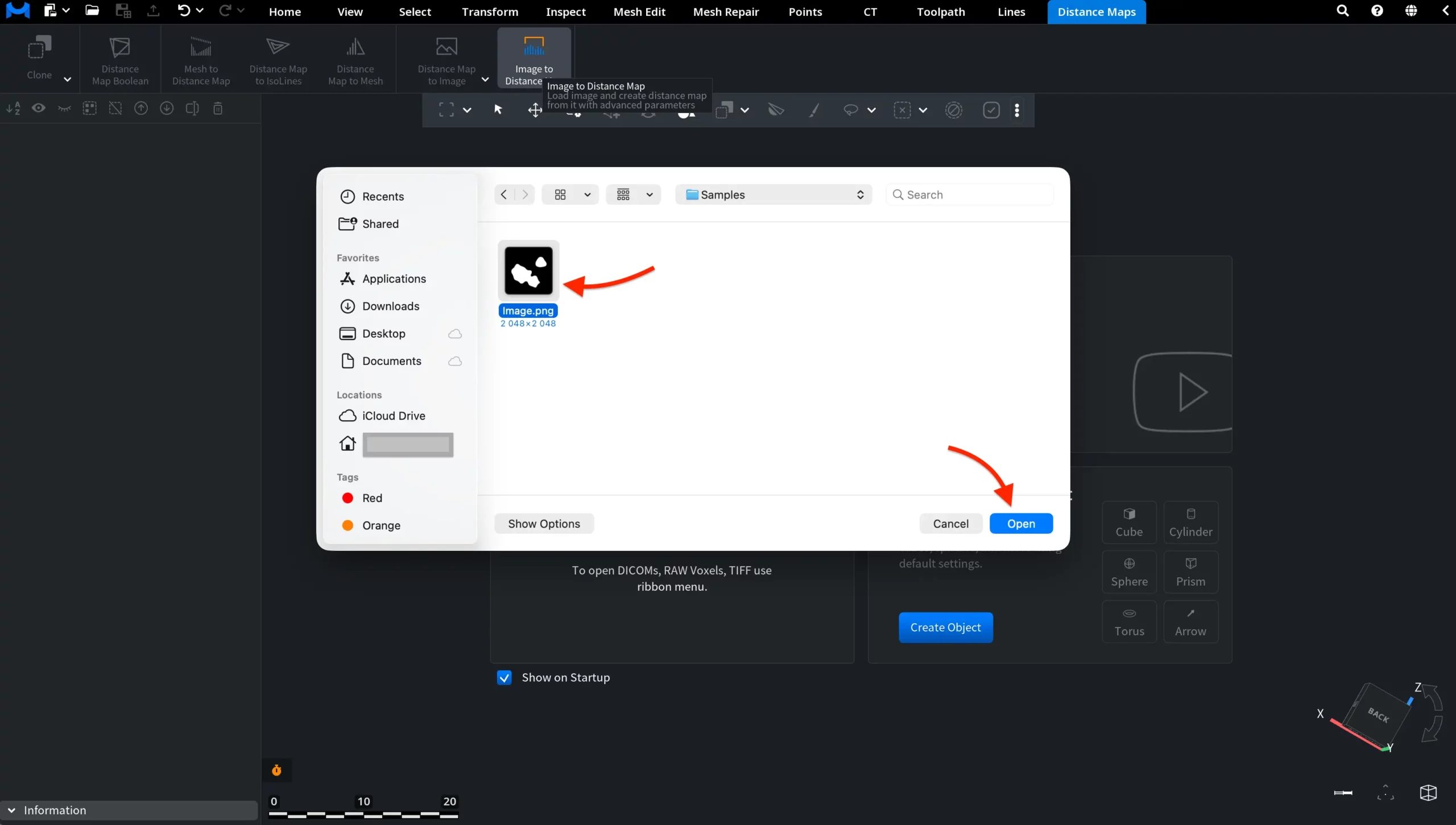
Brighter pixels become higher points: white gets the full Max Height. Color images are converted to brightness first.
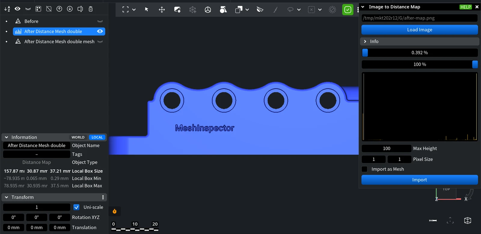
Panel settings
| Setting | What it does | Default / tip |
|---|---|---|
| File path and Load Image | The loaded file; click Load Image to choose another one. | — |
| Info | Collapsible block with the image resolution. | — |
| Upper slider | Pixels darker than this percentage of white become empty (no data). | 0.392%: pure black pixels are empty |
| Lower slider | Pixels lighter than this percentage of white become empty. | 100%: nothing is cut |
| Histogram | How many pixels have each brightness; two vertical markers show the slider positions. | Use it to place the sliders between the background and the part |
| Max Height | Height given to white. Other gray levels get a proportional height. | 100 |
| Pixel Size | Size of one pixel in scene units, along X and Y (two fields). Sets the width and length of the result. | 1 × 1 |
| Import as Mesh | Creates a mesh instead of a distance map. | Off |
Click Import to create the object. It is named after the image file and appears in the Scene tree; the panel stays open, so you can change the settings and import again.
Example: a depth image loaded back
The image below was exported with Distance Map to Image from a map of a part with engraved text, then loaded back with Pixel Size 0.13 × 0.13 (the pixel size of the original map) and Max Height 5. The image does not carry the real size, so these values were set by hand.
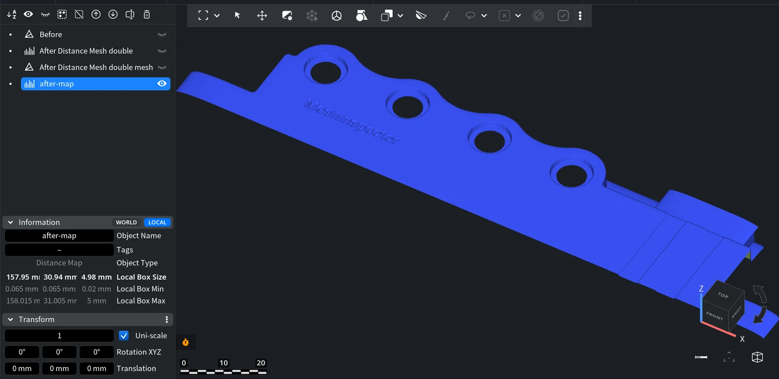
To get a mesh from a distance map you imported, use Distance Map to Mesh, or turn on Import as Mesh before Import.


