The Distance Map Boolean tool, located under the Distance Maps tab, allows you to create a new distance map from two existing distance map objects. The result is calculated by combining the distance values of the selected maps using one of the available operations: Merge Max, Merge Min, or Subtraction.

To make the tool active and clickable, users should select exactly two Distance Map objects in the Scene tree.
In the example below, two distance map objects are loaded into the scene. One object is selected, while the other remains unselected, so you can clearly see the difference between them in both the viewport and the Scene tree.
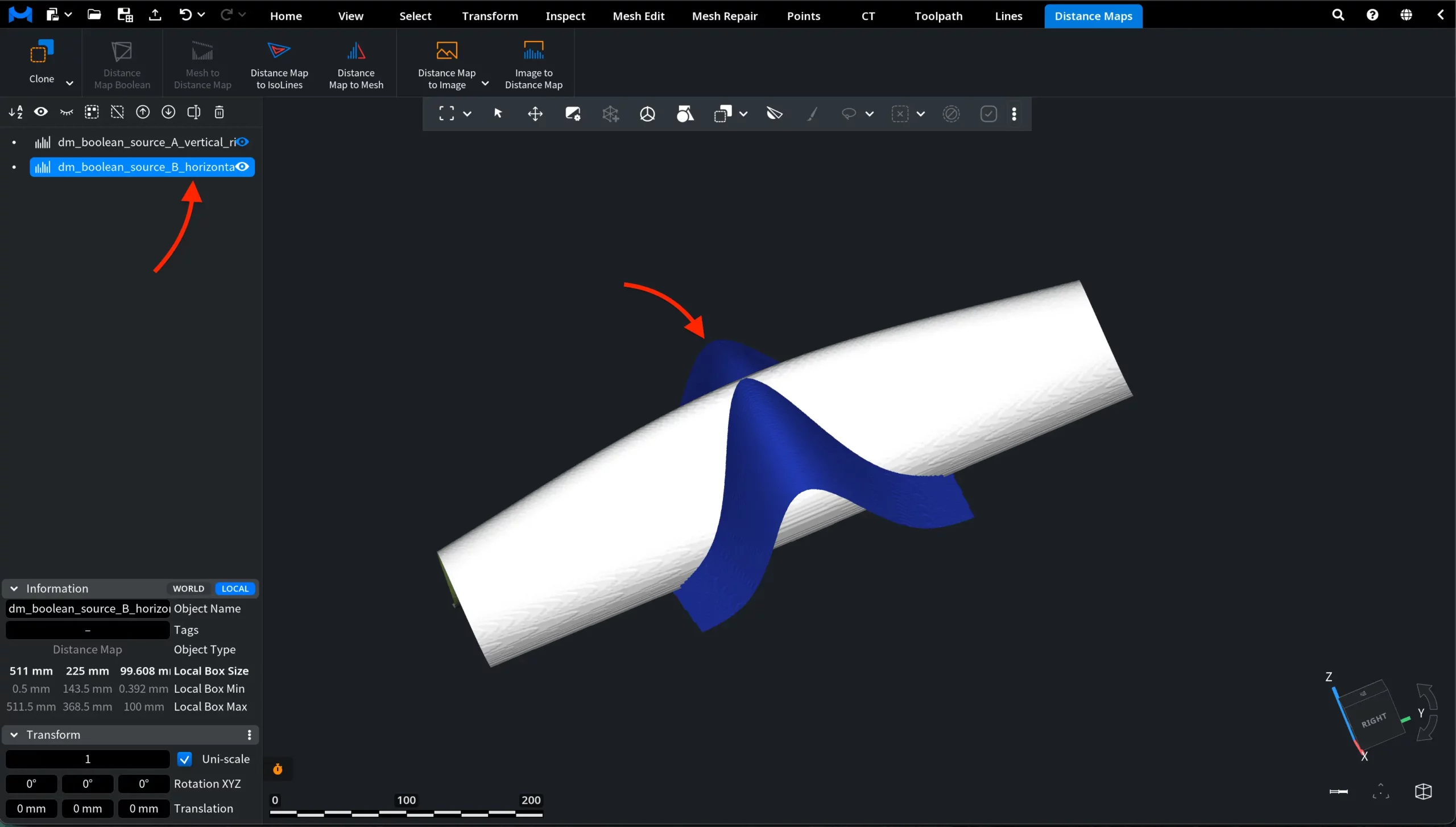
At this stage, the Distance Map Boolean tool is still unavailable. To make it active and clickable, select exactly two Distance Map objects in the Scene tree.
Using the Distance Map Boolean Panel
With two Distance Map objects selected, click Distance Map Boolean under the Distance Maps tab. MeshInspector opens a dedicated panel for the operation.
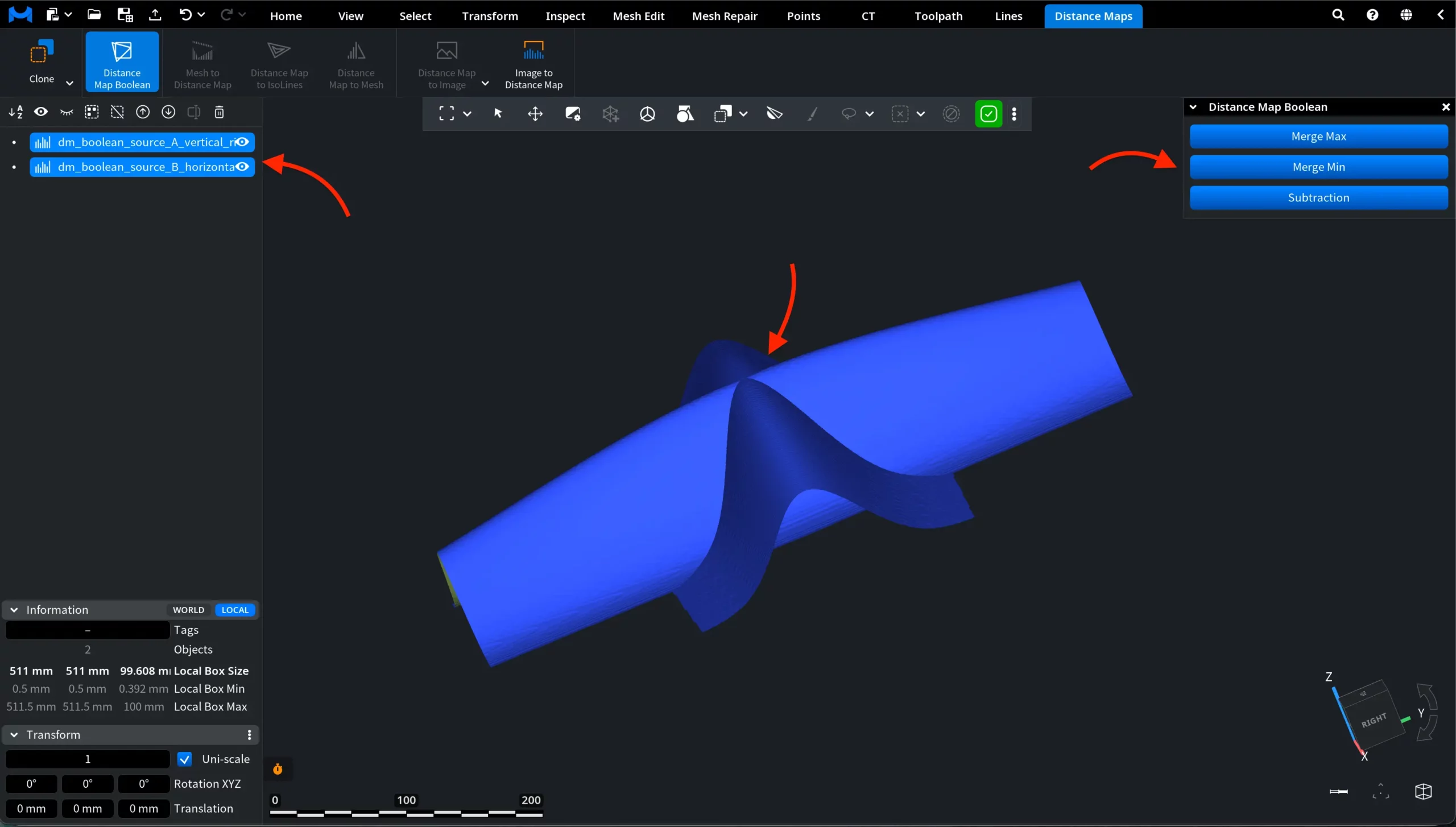
The panel contains three options:
- Merge Max creates a new distance map by taking the maximum value from the two selected distance maps.
- Merge Min creates a new distance map by taking the minimum value from the two selected distance maps.
- Subtraction creates a new distance map based on the difference between the values of the two selected distance maps.
These operations work with the values stored in distance maps rather than with mesh geometry. As a result, the output is created as a new Distance Map object in the Scene tree, while the original two maps remain unchanged.
Merge Max
After clicking Merge Max, MeshInspector creates a new distance map object and adds it to the Scene tree. In this example, the two source distance maps were hidden after the operation, so only the generated Distance Map Max object remains visible in the viewport.
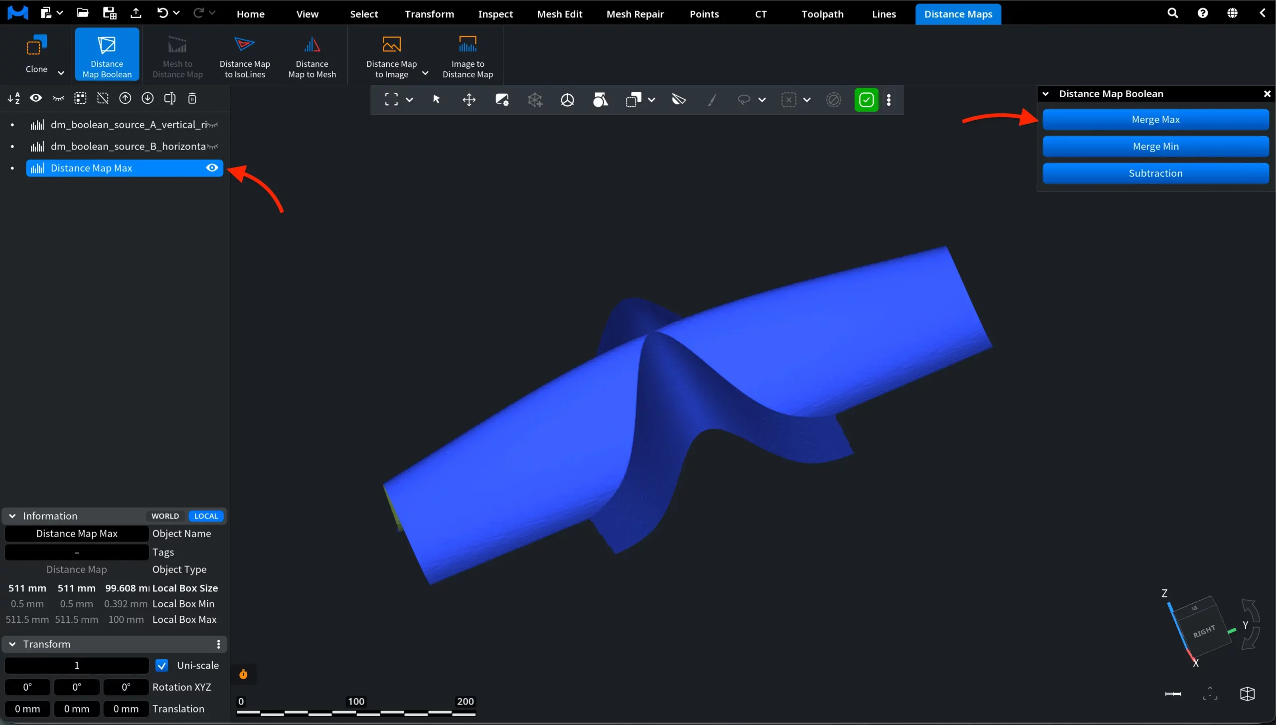
The result combines the two input maps by taking the maximum value at each corresponding position. The generated distance map keeps the higher-value regions from both source maps. In this example, you can see that the resulting object contains features from both original distance maps.
Merge Min
After clicking Merge Min, MeshInspector creates a new distance map object and adds it to the Scene tree. In this example, the two source distance maps are hidden, so only the generated Distance Map Min object is visible in the viewport.
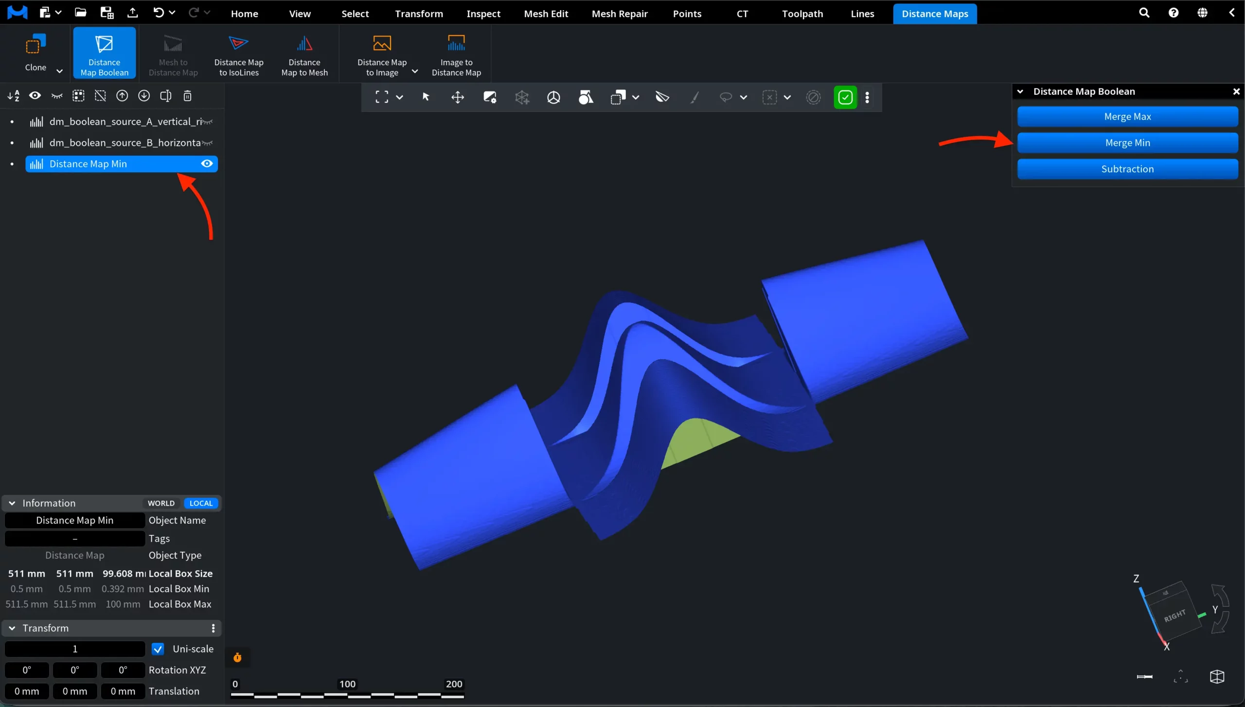
This operation takes the minimum value from the two selected distance maps at each corresponding position. As a result, the new distance map keeps the lower-value regions from the input maps.
Compared with Merge Max, the result can look noticeably different because the operation prioritizes the smaller distance values instead of the larger ones. In this example, the generated map has a more segmented shape, reflecting the areas where lower values were taken from the selected source maps.
Subtraction
After clicking Subtraction, MeshInspector creates a new distance map object and adds it to the Scene tree. In this example, the two source distance maps are hidden, so only the generated Distance Map Sub object is visible in the viewport.
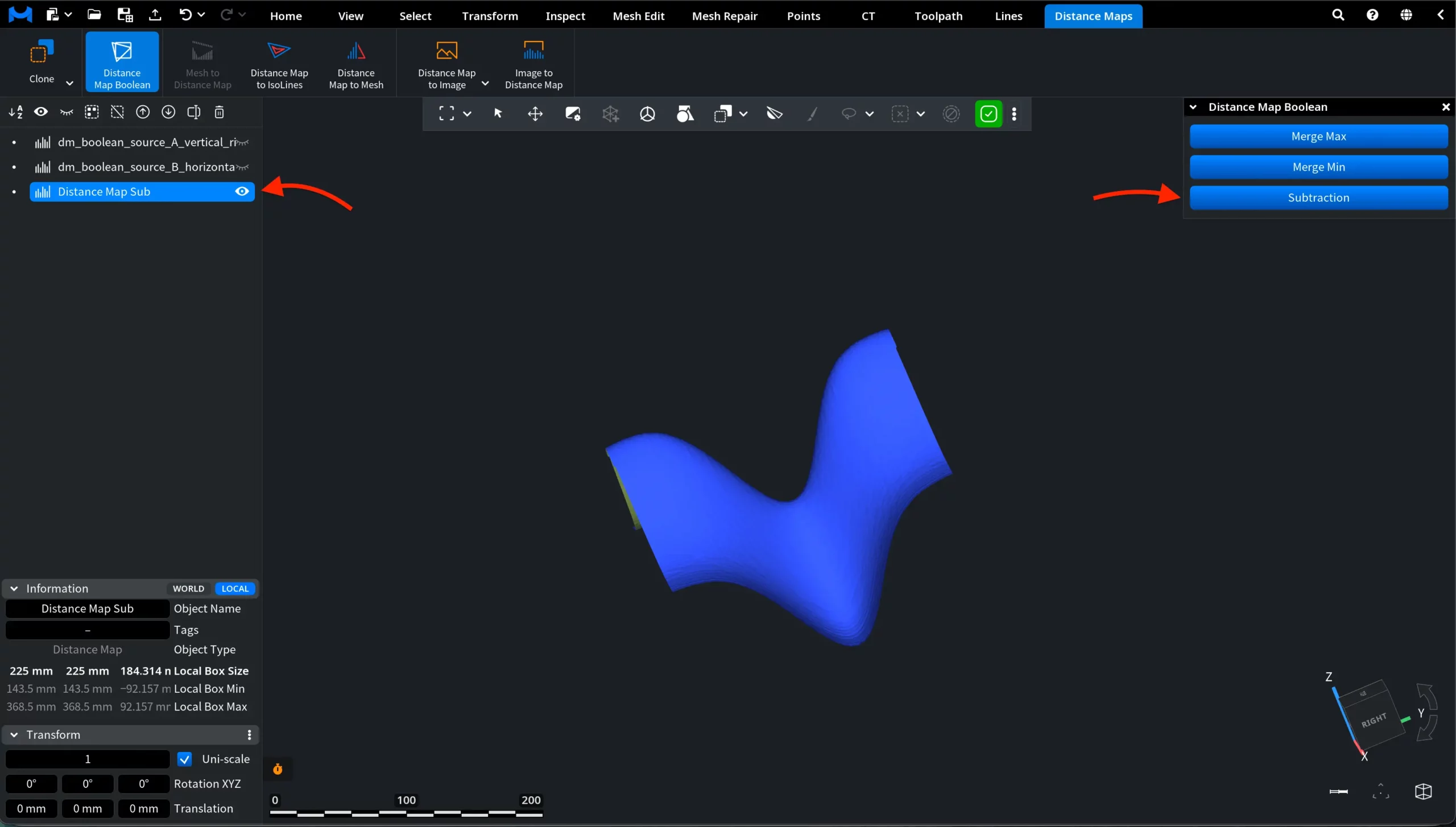
This operation creates a new distance map based on the difference between the values of the two selected distance maps at each corresponding position. Thus, the output highlights how one distance map differs from the other.
Compared with Merge Max and Merge Min, Subtraction usually produces a more visually distinct result because it does not simply keep the higher or lower values. Instead, it shows the value difference between the two source maps.