
Distance Map to Mesh (Distance Maps › Distance Map to Mesh) turns a distance map into a regular mesh that you can edit, measure and export. Use it after Image to Distance Map or Distance Map Boolean to continue working with the result as a mesh.

Convert a distance map
- Select exactly one Distance Map object in the Scene tree.
- Click Distance Map to Mesh.
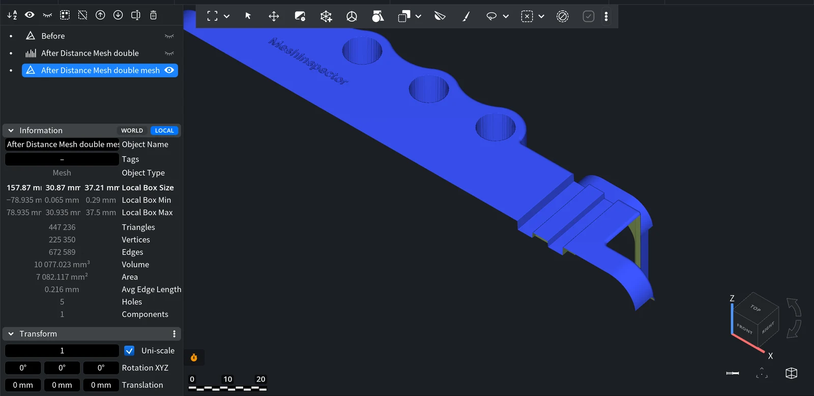
The tool has no panel and no parameters: it runs at once. A new mesh named <map name> mesh appears in the Scene tree. The distance map stays in the scene unchanged, so hide it to see the mesh alone.
What the result is
- The mesh is a single surface that follows the map pixel by pixel. It is open, not a closed solid: in the example above, the Information panel counts 5 holes (the outer border and four through-holes of the part).
- The mesh density follows the map resolution: a 1,216 × 239 map gave about 447 thousand triangles. Large maps give heavy meshes; reduce them with Simplify if needed.
- To turn the surface into a printable solid, give it thickness, for example with Hollow / Thicken.
If you start from an image, you can skip this step: Image to Distance Map has an Import as Mesh option that creates the mesh directly.


