Lines and distance maps are the two "in-between" object types of MeshInspector. You rarely open them as files: you get them from a mesh or a point cloud, edit them, and turn them into a mesh again. This guide explains both types, where they come from, what you can make of them, and which tool of the Lines and Distance Maps tabs does what.
Lines and Distance Maps
- A polyline (a lines object) is a chain of straight segments: an ordered set of vertices joined by edges, open or closed, without thickness. A section contour, an outline or a path is a polyline. See Polylines.
- A distance map is a regular 2D grid of distance values, like a depth or height map, shown in the viewport as a relief. See Distance Maps.
For a selected lines object, the Information panel shows the Vertices, Edges, Length, Avg Edge Length and Components of the polyline.
Where Lines Come From
| Source | Tool | Result |
|---|---|---|
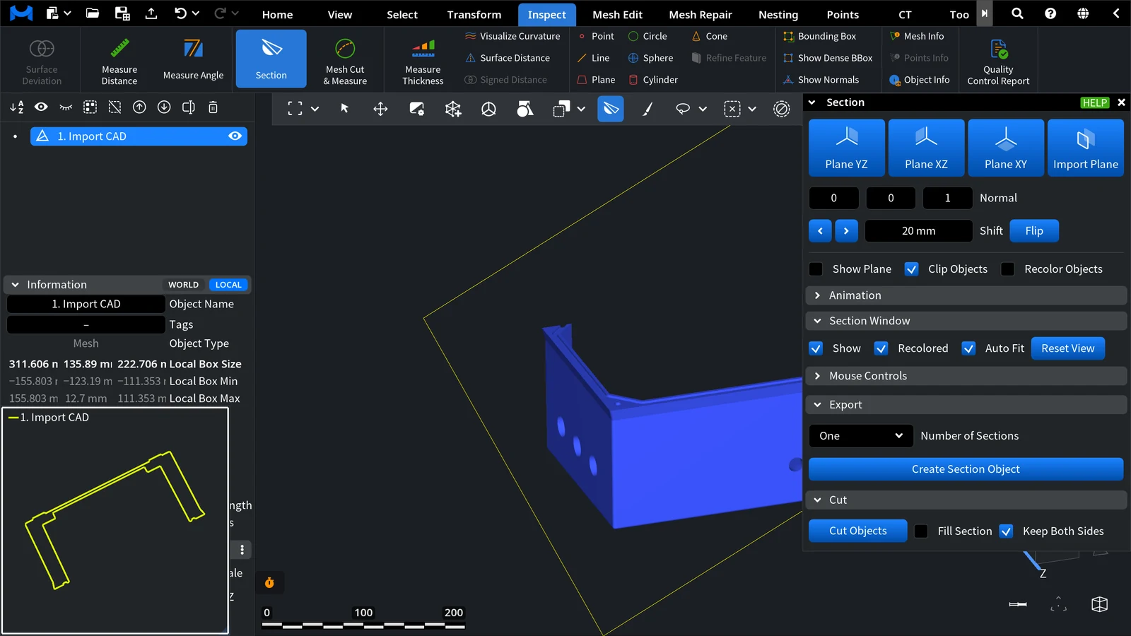
| A cross-section of a mesh | Inspect › Section, then Export › Create Section Object | A lines object (Section0, …) under the cut object |
| Iso-lines of a distance map | Distance Maps › Distance Map to IsoLines | Contour lines at the chosen levels |
| A point cloud | Points › Points to Lines | One line through the points in their order |
| A file | Open Files with an SVG drawing or a MeshLib .mrlines file | A lines object |
A lines object can be saved as .mrlines, PTS, PLY or DXF with Save object.
What You Can Turn Lines Into
- A flat mesh from closed contours: Lines to Mesh.
- A tube of constant radius around the line: Offset.
- A swept body: a profile moved along an axis or along another line, with Extrusion Body.
- A point cloud, voxels or a distance map: Lines to Points, Lines to Voxels, Lines to Distance Map.
The Lines Tab at a Glance
| Task | Tools |
|---|---|
| Combine, copy, set direction | Combine, Clone, Delete Colors, Flip Orientation |
| Check a line | Lines Info, Lines Derivative |
| Edit a line or make a mesh along it | To Components, Simplify, Subdivide, Reduce Noise, Offset, Extrusion Body, To Spline |
| Convert to another object type | Lines to Distance Map, Lines to Mesh, Lines to Points, Lines to Voxels |
Combine, Clone, Delete Colors, To Components, Subdivide and Reduce Noise are the same buttons as on the mesh and point tabs; their guides have a part about lines.
The Distance Maps Tab at a Glance
| Tool | What it does |
|---|---|
| Mesh to Distance Map | Makes a depth map of the selected mesh |
| Distance Map to Mesh | Turns a distance map back into a mesh |
| Distance Map to IsoLines | Makes lines at chosen distance levels |
| Distance Map to Image | Saves the map as an image; Distance Map to Image Advanced is in its drop-down |
| Image to Distance Map | Loads an image as a distance map |
| Distance Map Boolean | Combines two maps: maximum, minimum or subtraction |
Clone is on this tab too.
Recipe: From a Section to a Solid
- Select the mesh and open Inspect › Section. Pick a plane (Plane XY, Plane XZ or Plane YZ) and drag Shift until the Section Window shows the contour you need.
- Open Export, keep Number of Sections at One and click Create Section Object. Close the tool.
- Select the new lines object. If the contour is noisy or very dense, use To Spline or Simplify first.
- Make the solid: Lines to Mesh for a flat plate from a closed contour, or Extrusion Body with Move Along Z Axis for a prism of the section's shape.


